Nearby Parks & Trails
Take a quick drive and check out these beautiful parks, trails, and lookouts with incredible scenery just outside of Clinton. Prior to visiting, ensure you check conditions online (Province of BC) to be aware of any closures or important notices.
Big Bar Provincial Park
Approximately 40 minutes from Clinton.
Big Bar Lake Park is easily accessible and provides a range of recreational opportunities for outdoor enthusiasts. Some of the major recreational opportunities available in the park include day-use picnicking, lakeside camping, boating, canoeing and kayaking, swimming, wildlife viewing, hiking, and fishing. READ MORE > Abundant rainbow trout typically reward the angler; fishing is active nearly all season but is typically the best between mid-May and late July. Nearby guest ranches offer horseback excursions into the open range that lies north of the lake. (BC Parks, 2021)
Read more about Big Bar Provincial Park here>.
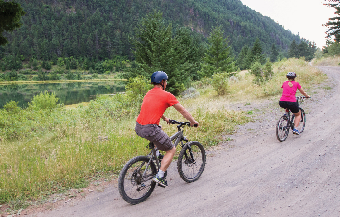
Photo Credits: Gold Country Communities Society
Big Bar Ski Trails
Approximately 15-20 minutes from Clinton.
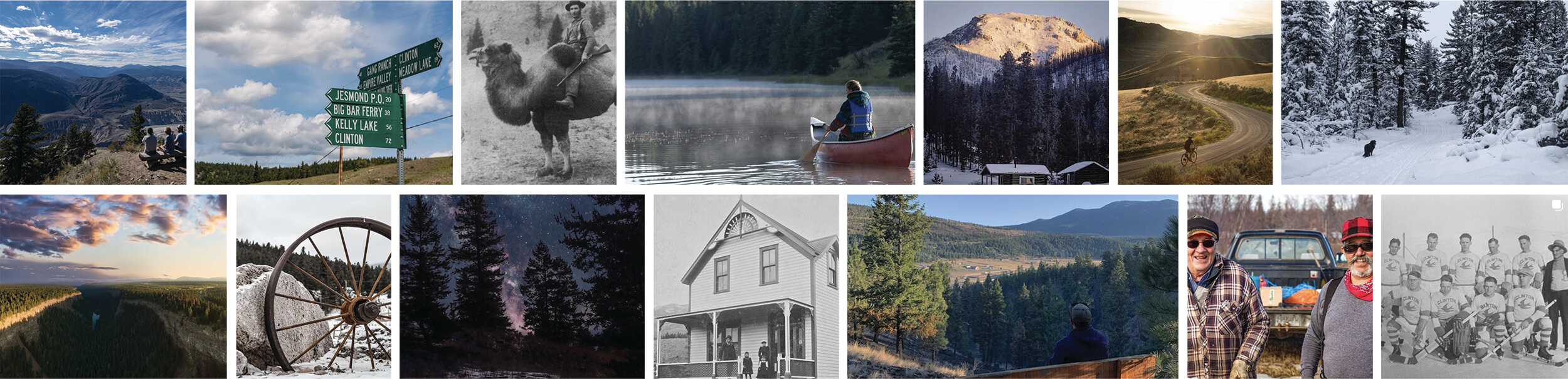
For outdoor enthusiasts, Clinton has 60 km of marked cross country ski trails which are also suitable for hiking and mountain biking in the summer. These trails are maintained by the Clinton Snow Jockey Club.
Read more about these trails and view maps HERE >

Photo Credits: Gold Country Communities Society
Chasm Ecological Reserve
Approximately 15 minutes from Clinton.
Located approximately 15 km north of Clinton, off Highway 97. The “Chasm” is a geological wonder which makes for spectacular viewing. The bedrock canyon is 1.5 km in length and 120 metres deep. The painted Chasm was created by glacial meltwaters thousands of years ago and is a great place to spend an evening or afternoon sightseeing and hiking.
Read more about the Chasm HERE >
Porcupine Creek Trail
Approximately 30 minutes from Clinton.
Porcupine Creek Trail is a 9.0 kilometer lightly trafficked out and back trail that features beautiful wildflowers and is rated as difficult. The trail is primarily used for hiking and bird watching.
Read more about this trail HERE >
Please check BC Parks Website for road access and trail updates.
Downing Provincial Park (Kelly Lake)
Approximately 15 minutes from Clinton.
This park is a small but popular park that almost encircles attractive Kelly Lake. Views of mountains, and 2,245 metre Mount Bowman, a spectacular mountain ridge visible from the nearby Jesmond Road, give the park a remote atmosphere, though it is located only 18km from Clinton. (BC Parks, 2021) READ MORE >
Read more about Downing Park and Kelly Lake HERE >
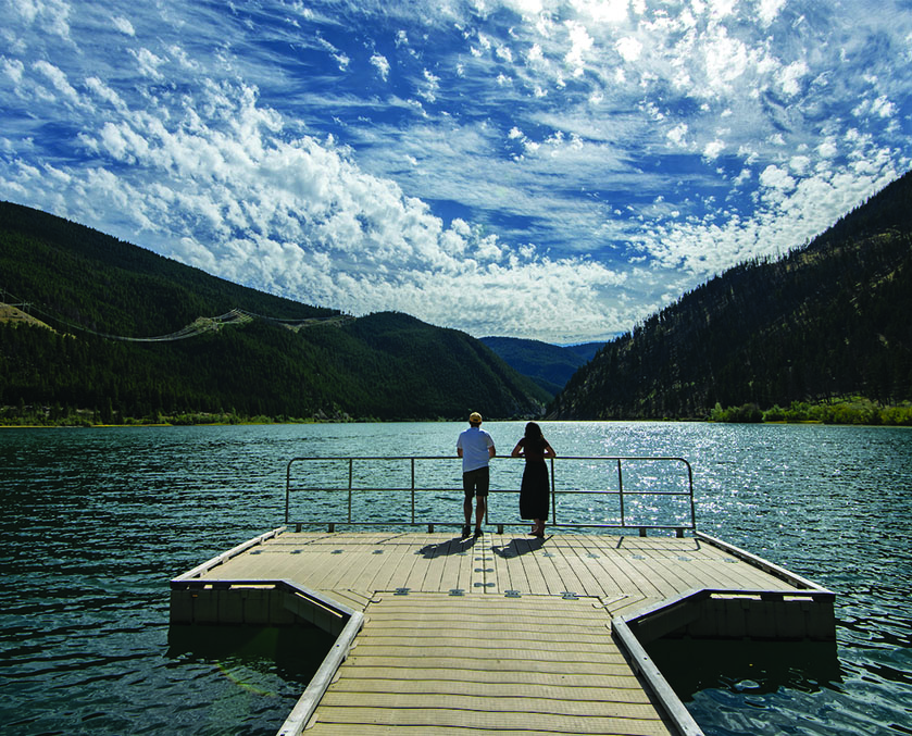
Photo Credits: Kelly Funk
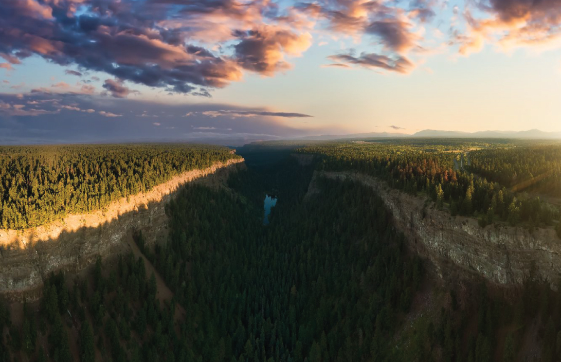
Edge Hills Provincial Park (Cougar Point)
Park entry is approximately 20 minutes from Clinton. Cougar Point is approximately 35 minutes from Clinton.
Edge Hills Provincial Park protects panoramic river canyon vistas, gentle forested slopes, and grassy benchlands and ravines on the eastern slope of the Fraser River. Such a diverse landscape provides habitat for a wide range of wildlife species. READ MORE >The protection of wildlife and their habitats is a critical element in the management of this wilderness park. The area also protects cultural heritage sites. Backcountry recreation opportunities offering spectacular views include hiking, horseback riding and wildlife viewing.
Edge Hills is an undeveloped wilderness park with no facilities except a network of unmaintained and unmarked trails. (BC Parks, 2021)
While at Edge Hills Park, be sure to stop at Cougar Point for excellent views of the Fraser River.
Read more about Edge Hills Provincial Park HERE >
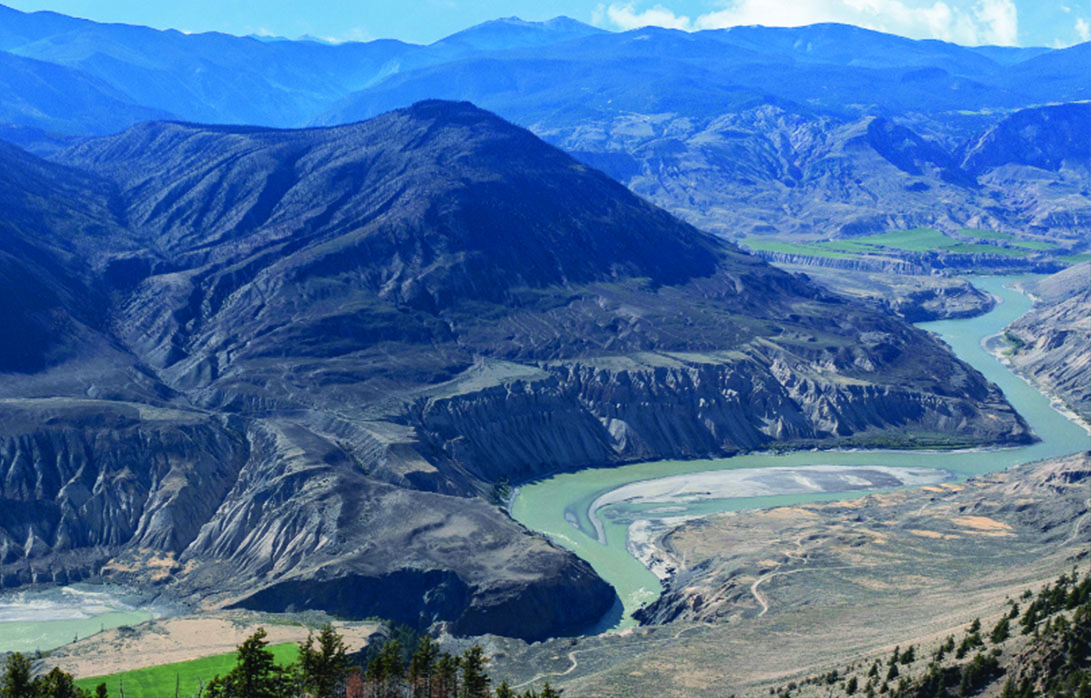
Photo Credits: Kelly Funk
Gold Rush Snowmobile Trail
Accessible from Clinton Station Road within the Village.
The Gold Rush Snowmobile Trail (GRST) runs from Clinton to Horsefly with many stopping points along the way. It is an initiative of the British Columbia Snowmobile Federation (BCSF) on behalf of the clubs local to the GRST including the Green Lake Snowmobile Club, 100 Mile House Snowmobile Club, the Williams Lake Powder Kings READ MORE >Snowmobile Club, the Quesnel Snowmobile Club, and the Wells Snowmobile Club. These five snowmobile clubs, in conjunction with Recreation Sites and Trails BC, maintain the GRST.
Read more and find the trail maps for the Gold Rush Snowmobile Trail HERE >
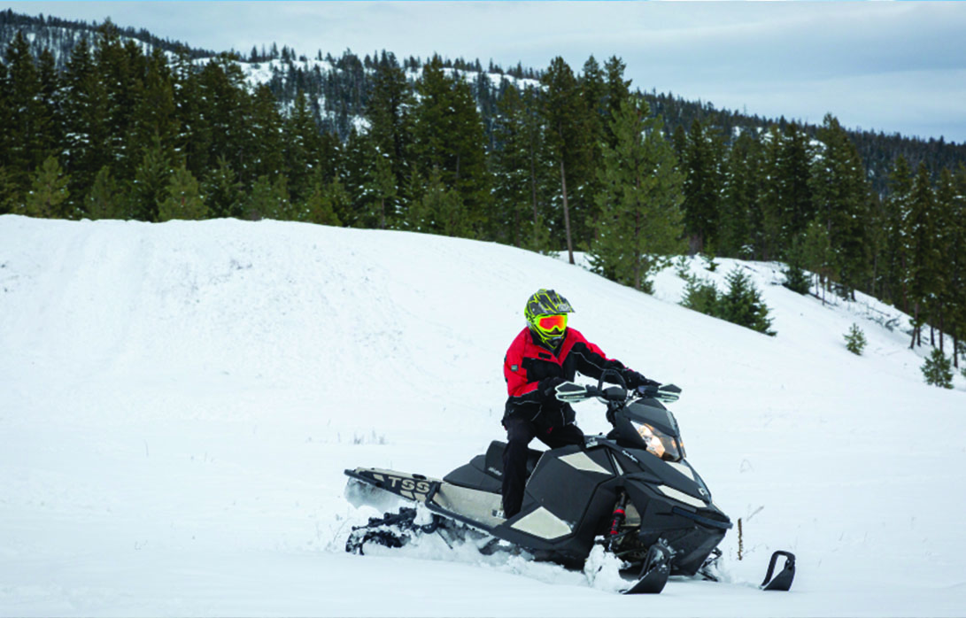
Photo Credits: Bonnie Pryce
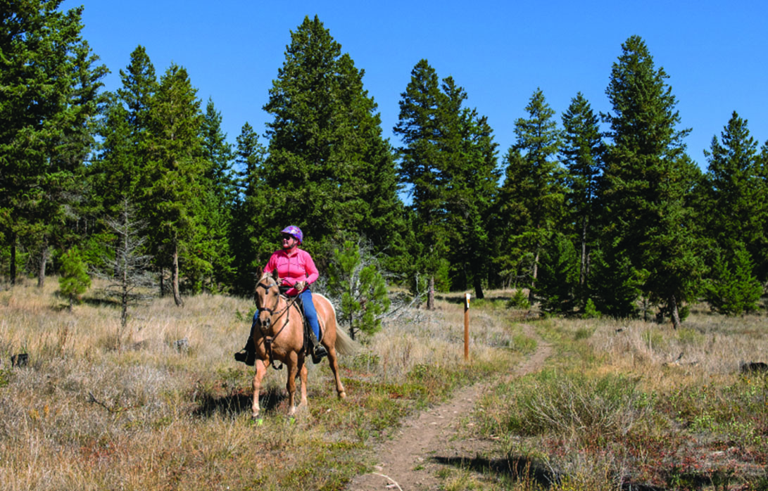
Haller and Grinder Recreation Trails – Rec Sites & Trails BC
Approximately 45min from Clinton.
A network of horseback riding and hiking trails near Clinton offering spectacular views of the Fraser River, the Haller and Grinder Recreation Trails are restricted to non-motorized use only.
Read more about the trails and access maps HERE >
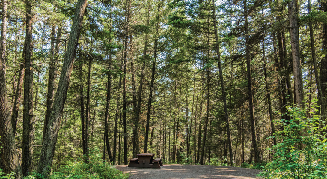
Photo Credits: Tarra Hinton
Jesmond Fire Lookout
Approximately 1.5hr from Clinton.
The Jesmond Fire Lookout recreation site is a former fire lookout tower built in the early 1970’s to aid with detecting forest fires. Access is via a rough 4WD road and ATVs or walking is recommended for the last part of the road to the peak. It is accessible from either Big Bar Road or Jesmond Road from both the North READ MORE >and South ends of Clinton.
As of 2020, First Journey Trails constructed a downhill mountain biking trail from the lookout down Jesmond Mountain. The trail can be found HERE >
Read more HERE >
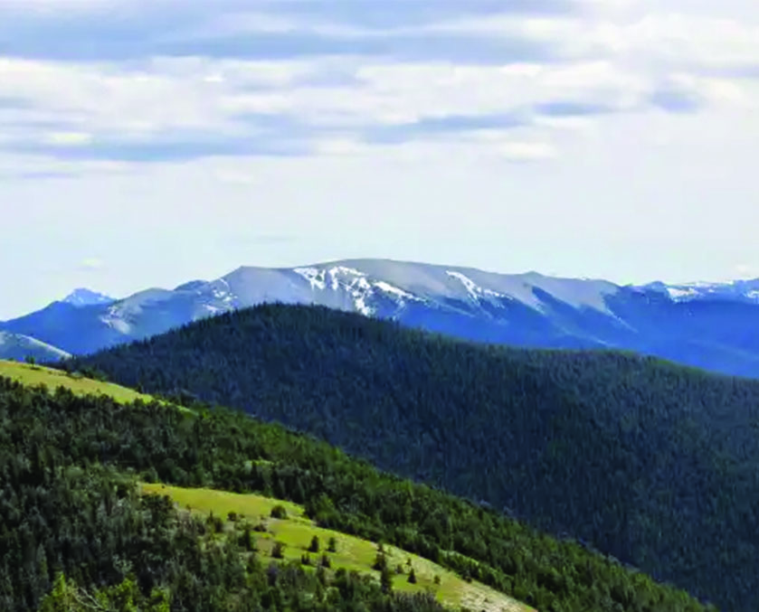
Photo Credits: Kelly Funk
Marble Canyon Provincial Park
Approximately 20 minutes from Clinton.
Located in the Pavilion Mountain Range, between Turquoise and Crown lakes, this small campsite is popular for birding, fishing and a great spot for a picnic and a quick dip on a warm day.
Read more HERE >
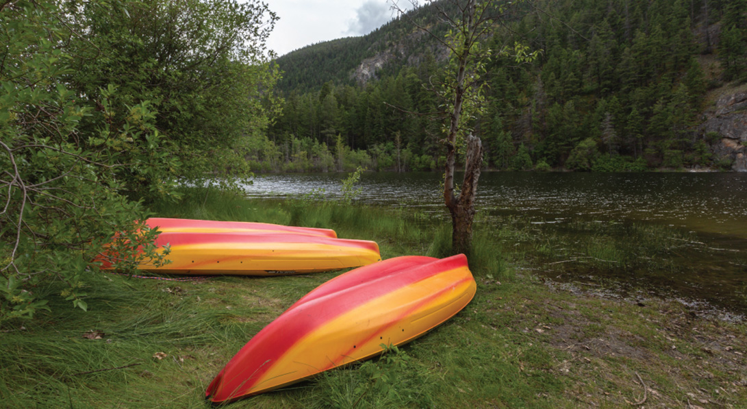
Photo Credits: Tarra Hinton
McAbee Fossil Beds
Approximately 35 minutes from Clinton.
Located directly outside Cache Creek, this fossil bed rests on part of an ancient lakebed deposited about 50 million years ago and is home to plants and insects from the Eocene Epoch geological time period (56 million to 33.9 million years ago). The McAbee Fossil Beds Heritage Site holds significant cultural READ MORE >and historical values and information.
Read more HERE >
Please note that as of March 2021, this site is closed to the public while interpretive components are installed.
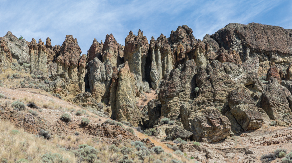
Photo Credits: Bonnie Pryce
Mount Bowman
Located approximately 45 minutes from Clinton – accessible from Jesmond Rd.
“Mount Bowman is a 11.9 kilometer lightly trafficked out and back trail located near Thompson-Nicola E, British Columbia, Canada that features a great forest setting and is rated as difficult. The trail is primarily used for hiking and backpacking.”
Read more HERE >
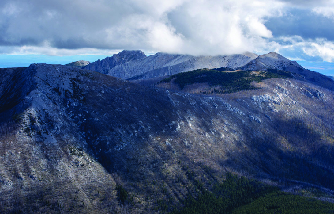
Photo Credits: Mary Putnam